












Ever looked at a Strava map and wondered how someone managed to turn a bike ride into a heart, an animal or even a name? That's Strava Art. Also known as GPS Art, it involves planning a cycling route so that your GPS track creates a picture, word or symbol on a map.
The idea is simple, but the finished result can be surprisingly creative. You might spend an afternoon riding a heart through your local streets, spell out your initials across a few neighbourhoods or use a longer route to create a more detailed drawing. If you're looking for a different kind of cycling challenges in the UK, GPS Art gives you a reason to plan a route with something more interesting in mind than just distance. With Shokz's Cycling Challenge coming in late October 2026, it's also a good time to start thinking about your next ride.
Table of Contents
What Is GPS Art?

GPS Art (Strava Art) is created by riding a GPS-tracked route that forms a particular shape or design when displayed on a map. Before setting off, you work out which roads and paths could make up the outline of your drawing. Once the ride is recorded, the GPS track reveals the finished artwork.
Strava is closely associated with GPS Art because it's widely used to record and share cycling activities, but you don't have to use Strava specifically. Other cycling apps and GPS devices can record a route in much the same way. What matters is being able to see the GPS track on a map once the ride is finished.
There are no fixed rules about what counts as Strava Art. Some cyclists stick to simple hearts, stars and initials, while others create animals, bicycles, landmarks, words and other detailed designs. The road network you have available will usually determine how ambitious you can be.
How Does Strava Art Work?
At its simplest, Strava Art is about planning a route, riding it and seeing what shape your GPS track creates on the map. The tricky part is that you can't simply draw whatever you want. Your design has to follow roads and paths that you can actually ride.
1. Choose a Design
Start with something that suits the distance and time you want to spend on the bike. A heart, initial or simple symbol is a good starting point because the shape is easy to recognise without requiring a huge route.
If you're creating GPS Art as part of a personal cycling challenge, you could choose something with a bit more meaning, such as your name, a favourite number or a symbol connected to your cycling club.
2. Plan Your Cycling Route
Once you have a design in mind, look at the roads in the area where you want to ride. Urban areas with connected streets can be particularly useful for letters and geometric shapes, while a mixture of city roads and quieter routes can give you more space for a larger drawing.
This is where most of the work happens. A line that looks perfect on your sketch might not match the roads on the ground, and a road closure, awkward junction or restricted cycle access can force you to change the plan. Check the route from start to finish before you ride and make sure every section is suitable for cycling.
3. Record Your Ride
When you're ready to go, use Strava or another GPS tracking app to record the ride. Try to follow your planned route as closely as possible, particularly around corners and sections that form important parts of the design.
Your first attempt probably won't look exactly like the sketch. That's part of the fun. A missed turn or unexpected detour can change the final shape, and you may find that your second attempt produces a much cleaner drawing.
4. Reveal and Share Your GPS Art
Once you've finished the ride, open the activity and view the route on a map. This is when the individual roads you've ridden come together to reveal the design. GPS Art is particularly easy to share because the route itself becomes the artwork. You can post the finished map for friends to see, compare designs with other cyclists or keep it as a record of a ride that was planned around something more than a distance target.
Strava Art Ideas for Cyclists
You don't need an elaborate plan to get started. In fact, simple designs can be more rewarding because you can focus on getting the route right rather than spending hours trying to fit a complicated picture onto the map.

Easy GPS Art Ideas for Beginners
Hearts, stars, arrows, numbers and initials are all good options for a first attempt. Letters can work particularly well in towns and cities where the street layout gives you plenty of turns to work with.
You could also create a simple word or combine a few letters into a personal design. A shorter route is often enough for this type of GPS drawing, so there's no need to turn your first attempt into an all-day ride.
More Creative GPS Drawing Ideas
Once you've got the basics down, you can try something more detailed. Animals, bicycles, landmarks and sports-related symbols are all possibilities, depending on the roads available in your area.
Another approach is to make the design part of the place you're riding through. A local landmark or recognisable symbol can give the route a connection to its surroundings, while a birthday, charity ride or group event can give you a reason to create something personal.
For group rides, everyone could even choose their own design and compare the finished GPS drawings afterwards.
Where to Try GPS Art in the UK
You don't need a famous cycling route to create GPS Art. In fact, the most useful locations are often places with a road layout that gives you plenty of options for shaping your route.
London: Urban Streets for Letters and Shapes

AI-generated route maps for inspiration only — please follow official maps or GPS for navigation.
London's dense network of streets can be useful for more structured GPS drawings. Different neighbourhoods have different layouts, so areas with connected residential streets can give you more flexibility when creating letters, symbols or smaller designs. For a longer drawing, you can work across several neighbourhoods, but make sure the route remains practical for cycling rather than choosing roads simply because they complete the shape.
Manchester and Birmingham: City Routes with More Room to Experiment

AI-generated route maps for inspiration only — please follow official maps or GPS for navigation.
The urban areas around Manchester and Birmingham offer a mixture of connected streets and longer routes extending beyond the city centre. That makes them useful if you want to move from a small symbol towards a larger GPS drawing. You can also combine more structured city sections with quieter roads outside the centre, depending on the design and distance you're aiming for.
Bristol: A Mix of Urban and Out-of-Town Riding

AI-generated route maps for inspiration only — please follow official maps or GPS for navigation.
Bristol can suit cyclists who want a GPS drawing with a mixture of urban streets and surrounding routes. The varied terrain means route planning matters, particularly if your design takes you across different parts of the city. It's a good example of why the most efficient GPS drawing isn't always the best cycling route. A slightly less precise design may be preferable if it keeps you on roads that are more comfortable to ride.
Edinburgh: City Streets and Distinctive Surroundings

AI-generated route maps for inspiration only — please follow official maps or GPS for navigation.
Edinburgh offers another interesting combination of urban roads and more open surroundings. You can use the city streets for smaller, structured designs or look further out if you're planning something larger. The surrounding landscape can also inspire the design itself, particularly if you want your GPS Art to reflect where you've been riding rather than simply creating a geometric shape.
Leeds: Options for Larger Designs
Leeds has a varied network of roads across the city and surrounding areas, giving you different options depending on the size of your GPS drawing. More connected urban sections can help with letters and shapes, while longer routes around the outskirts can give larger designs more room. Wherever you ride, check cycle access, traffic conditions and the full route before setting off. A road that looks perfect for your GPS drawing isn't necessarily one you should use on a bike.
Turn GPS Art Into Your Next Cycling Challenge
Part of the appeal of GPS Art is that it changes the way you think about a cycling route. Instead of deciding where to ride based only on distance, speed or a familiar loop, you have a design to work towards.
That makes it a natural fit for a cycling challenge. You could set yourself the goal of creating your first GPS drawing, completing a particular design within a certain distance or exploring a part of your local area you've never cycled through before.
It can also work well as a group challenge. Give everyone the same distance or theme and see what different designs they come up with. The rides may start with the same idea, but the finished GPS tracks are likely to look very different.
If you're looking for a new cycling goal this autumn, Shokz will be launching its Cycling Challenge in late October 2026, giving cyclists another reason to plan a route and get out on the bike.
Ready to Create Your Own Cycling Art?
Strava Art is a fun way to turn an ordinary bike ride into a personal cycling challenge. Choose a design, plan a route and see what you can create on the map — whether it's your first heart, a set of initials or something more ambitious.
🚴 Shokz Online Cycling Challenge
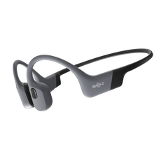
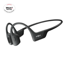
Shokz will be launching its Cycling Challenge in late October 2026, so it's a good time to start planning your next ride. And with open-ear headphones like the OpenRun Pro 2, you can enjoy audio while keeping your ears uncovered for greater awareness of your surroundings.


Frequently Asked Questions About Strava Art
What Is Strava Art?
Strava Art is a type of GPS Art where cyclists plan and ride a route that creates a picture, word or symbol when the GPS track is displayed on a map. Simple designs can include hearts and initials, while more advanced routes can create animals, landmarks and other detailed shapes.
How Do You Create Strava Art?
To create Strava Art, start by choosing a design and planning a cycling route that follows roads or cycle paths in the shape you want. Record the ride using Strava or another GPS tracking app, then view the completed route on a map to see the finished artwork.
Do You Need Strava to Create GPS Art?
No. Although Strava is one of the most popular platforms for sharing GPS-based cycling activities, you can create GPS Art with other cycling apps or GPS devices that accurately record your route. The important thing is being able to view your GPS track on a map after the ride.
How Far Do You Need to Cycle to Create GPS Art?
There is no set distance for GPS Art. A simple design such as a heart, letter or symbol can often be created with a relatively short cycling route, while larger or more detailed drawings may require a longer ride. Choose a design that fits the distance and time you want to spend cycling.
Where Can You Create GPS Art in the UK?
You can create GPS Art anywhere with a suitable network of roads and cycle paths. Cities such as London, Manchester, Birmingham, Edinburgh, Bristol and Leeds offer different possibilities for route planning, particularly where connected streets make it easier to create shapes and letters.
Is Strava Art a Good Cycling Challenge?
Yes. Creating GPS Art can turn a regular bike ride into a personal cycling challenge by giving you a specific route or design to complete. You can set your own distance, choose a design and share the finished GPS drawing with friends or the wider cycling community.